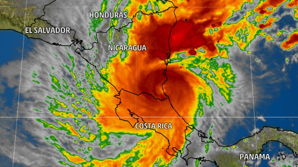
El Niño May Develop in Late 2017 and Could Impact Hurricane Season
El Niño may develop late this summer or in early fall, according to an update issued Thursday by NOAA’s Climate Prediction Center. This could limit the development and strength of tropical cyclones.
But scientists caution there are many uncertainties with this forecast.
Currently, neutral conditions of the El Niño – Southern Oscillation (ENSO) are in place, meaning there are near-average sea surface temperatures in the central equatorial Pacific region and neither El Niño or La Niña conditions are present. In addition, the overall ocean and atmosphere system is consistent with ENSO-neutral conditions.
However, above-average sea surface temperatures are occurring in the eastern equatorial Pacific Ocean.
(MORE: Could Leftover Heat From the Last El Niño Fuel a New One?)
This “coastal El Niño” caused heavy rain in parts of Ecuador and northern Peru. These local events are different than the El Niño that spans the width of the Pacific Ocean basin.
This is a typical time of year for such a coastal occurrence because sea surface temperatures are usually near the warmest of the year. Sometimes coastal warming can be followed by an El Niño event that encompasses the tropical Pacific, according to NOAA.

The chance for various phases of El Niño, according to IRI’s mid-April’s model-based probabilistic forecast. Red bars show the probability of El Niño’s development during each three-month period. (International Research Institute for Climate and Society)
The above graph shows that based on observational and predictive information, that the chances for El Niño increase to around 50 percent beginning in August.
The outlook from the Climate Prediction Center indicates that chances for El Niño increase to about 50 percent from about August to December. Before August, neutral conditions are expected to persist.
(MORE: April – June Temperature Outlook)
Many computer models predict the development of El Niño later this year, but conditions in the tropical Pacific do not show some of the signs that typically appear ahead of a developing El Niño.
The lines on the image below represent various model forecasts for water temperature anomalies in the Nino 3.4 region that is used to determine whether El Niño, La Niña or neutral conditions are present in the the eastern and central equatorial Pacific Ocean. Beginning later this summer some of the models exceed the 0.5 degree Celsius anomaly, favorable for El Niño development. However, as you can see, not all the models agree.

Dynamical and statistical model forecasts of three-month mean sea-surface temperature anomalies in the Nino 3.4 region from spring into next winter. (IRI/CPC)
Currently, the western and central Pacific are exhibiting conditions more similar to La Niña, while in the eastern Pacific the “coastal El Niño” is in place. In the central Pacific, even water temperatures below the surface are below average, which is not usually what is looked for ahead of an El Niño.
In addition, sea surface temperatures in portions of the eastern Pacific have experienced a recent cooling, adding to the difficulty of the forecast.
It is also important to remember that we are still in the spring ENSO predictability barrier, meaning that climate models have a more difficult time making accurate forecasts.
One other interesting note that only once since 1950 have we seen a sequence of El Niño, La Niña, El Niño during three consecutive years, which happened from 1963 to 1966, according to NOAA.
What Impacts Can Be Expected If El Niño Develops?
In terms of weather impacts, the atmospheric response to El Niño is what matters, and it is too early to tell when and how strong the response will be, assuming El Niño develops at all.
Generally speaking, there is a link between El Ninõ and increased wind shear in the tropical Atlantic Basin. Wind shear limits both the development and strength of tropical cyclones.

The effects of El Niño in the eastern Pacific, Caribbean and western Atlantic Ocean.
This is one of the factors that contributed to the 2017 Atlantic hurricane season outlook issued recently by Colorado State University, which calls for a slightly below average number of named storms and hurricanes.
(MORE: 2017 Atlantic Hurricane Season Forecast Calls For Less Activity Than 2016)
The most recent El Niño occurred in 2015 and that year the Atlantic hurricane season saw a slightly below-average number of tropical cyclones, with 11 named storms, 4 hurricanes and 2 major hurricanes. The 30-year average is 12 named storms, 6 hurricanes and 2 major hurricanes.
If El Niño develops, parts of the U.S. could see cooler-than-average temperatures later in the summer, according to Dr. Todd Crawford, chief meteorologist with The Weather Company.
Keep in mind that El Niño is only one factor of the atmospheric pattern, but it can play an important role in the weather in the U.S.


