
EUROPEAN HURRICANE STRIKE

Posted 10-13-17
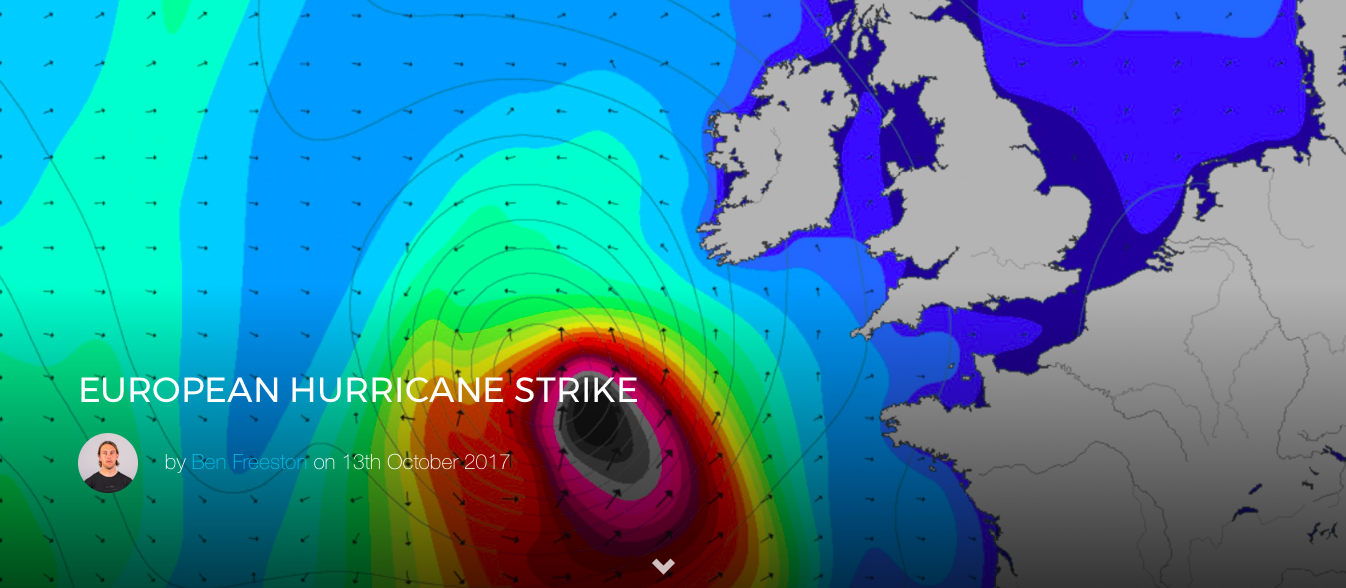
This hurricane season has been no joke. Sure, surfers have scored, but there have been direct hits and significant damage. Despite this, you’d probably put Ireland on a list of places that really, really don’t need to expect a Hurricane. Not so today. Ophelia is heading that way. It’s already generating significant surf and it could make landfall in Ireland early next week*.

That this is unusual will probably come as a surprise to some. European news editors have cottoned on to selling every ex-hurricane system that meanders towards the coast as a direct tropical strike. Misguided weather clickbait aside, the transition from warm to cold core storm is far from unusual this time of year. While these storms might offer the first blast of a winter season, they’re not generally offering the 21ft @ 18 seconds with 60mph onshores that are currently forming part of the forecast for Tramore in Southern Ireland next Tuesday morning. A European landfall hasn’t happened in 55-years and, if it comes off, as most models are indicating, it’s something you might not live long enough to see again: An actual 50-year storm.
Of course, unusual storms are no guarantee of epic surf. While this storm could offer some of the largest surf of the season so far in mainland Europe (check the forecast for the Algarve) the real story is further north. A fetch pushing the most unusual south swell towards those spots that see it so rarely there might mean there’s no one about who knows quite how they’ll work. 8ft @ 19 seconds for Iceland with light local winds sound interesting? Pumping swell running up St George’s Channel to the surprisingly well-oriented setups of the Isle of Man? This is one for the searchers and seekers if it comes in as called.
There’s plenty of time for this all to change. Hurricanes are fickle beasts and this one is likely no different. Check your local forecast for an updated outlook every six hours or fire your questions below. Follow me on Instagram for my latest thoughts on this storm.
© 2017 – 3D Storm Flyover
* While this storm is extremely unusual, winds of the current forecast strength aren’t so strange in Ireland. The expectations at this stage shouldn’t be for damage or destruction on anything like the scale we’ve seen elsewhere this season. However check your local agency forecasts for guidance, particularly as we move into the weekend and the local picture becomes clearer.

(C) Towsurfer.com 2017
More From Towsurfer
 Sean Collins Inducted Into Seal Beach Surfing Hall of Fame
 World Surf League confirms first public event at Kelly Slater’s wave pool for May 2018
 SOOO PITTED! THE GREATEST SURF HOAX OF MAINSTREAM MEDIA!
 WORLD’S BEST SURFERS PREPARE FOR HURLEY PRO AT TRESTLES
 HURRICANE IRMA IS BATTERING FLORIDA
 Near-Tragedy: Eli Olson And Company Save A Bodyboarder At Skeleton Bay